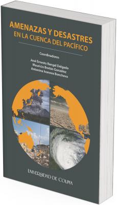
Threats and Disasters in the Pacific Rim
Keywords:
Risk geographies, vulnerability, climactic change, earthquakes, cyclones, volcanoes, tsunamisSynopsis
Tsunamis, volcanic eruptions, hurricanes, and earthquakes are permanent threats in the region of the Pacific Rim. Disasters, generated by deficient risk management are quantifiable as well as worrying. On a global level, between 2005 and 2014, Asia had 40% of natural nature phenomenon that generated disasters, which turns the area into the most susceptible to receive such impacts. In other words, according to the Disaster Report in Asia-Pacific (2015): “An inhabitant of Asia-Pacific has double the probability of being affected by a disaster than a person who lives in Africa, almost six times that of someone who lives in Latin America and the Caribbean, and thirty times more than someone who lives in North America or Europe”. Thus, the study of the causes, the impacts, and the ways of facing the threats and disasters acquire greater relevance. This is why various disciplines intervene from their own conceptual frameworks; Economy, in order to generate awareness on material losses, Sociology, in order to interpret the impacts of different socio-economic tolls; History, so as to better understand the tendencies of the threats and disasters; Linguistics, for proper communication in due time and proper course with the communities at risk; Computer Science, Telematics, Robotics, and Mechatronics, in preventions/solutions; Biology, with heating/contamination of the seas; among other disciplines that are involved with tending to these high impact problems.
This book presents different perspectives in search of providing tools which make it possible to implement opportune integrating strategies to develop an efficient risk management, mainly in the Pacific Rim which is the area of the planet where this represents a fundamental challenge for the further development of the region. We must not forget that if there are disasters, they will affect development.
Downloads
References
Get persistent links for your reference list or bibliography.
Copy and paste the list, we’ll match with our metadata and return the links.
Members may also deposit reference lists here too.
Asia Pacific Economic Cooperation (APEC) (2019). Tomado de: https://www.apec.org/Press/Features/2019/0613_risk
Baxter, P.J. (1990). Medical Effects of Volcanic Eruptions. Bulletin of Volcanology September, 52(7): 532-544. Tomado de: https://doi.org/10.1007/BF00301534
Bretón González, M. (2018). Las erupciones volcánicas y sus consecuencias en la Cuenca del Pacífico. PORTES, Revista mexicana de estudios sobre la Cuenca del Pacífico, 12(23): 165-177. Tomado de: http://www.portesasiapacifico.com.mx/index.php
Bretón González, M. (2012). ¡Los volcanes! Colección Ciencia Aventura, Núm. 2. México: Universidad de Colima.
Delmelle, P.; Stix, J.; Baxter, P.J.; García-Álvarez, J. y Barquero, J. (2002). Atmospheric Dispersion, Environmental Effects and Potential Health Hazard Associated with the Low-Altitude Gas Plume of Masaya Volcano, Nicaragua. Bulletin of Volcanology, https://doi.org/10.1007/s00445-002-0221-6
El Nuevo Diario (2016) ¿Qué es el Cinturón de Fuego del Pacífico? Managua, Nicaragua. Publicado el 22 de abril. Tomado de: http://www.elnuevo-diario.com.ni/nacionales/390835-que-es-cinturon-fuego-pacifico/
Fagan, B. (2008). La pequeña edad de hielo. Cómo el clima afectó a la historia de Europa, 1300-1850. Extensión Científica Ciencia para Todos. Barcelona: Gedisa.
Geological Society of Philippines (GSP) (2019). Tomado de: https://www.geolsocphil.org/
Geological Survey of Indonesia (GSI) (2019). Tomado de: https://rig-rock-sense.com/services/geological-survey/
Geological Survey of Japan (GSJ) (2019). Tomado de: https://www.gsj.jp/en/
Gill, R. (2010). Chapter 6. Andesite, Dacite and Rhyolite. In: Igneous Rocks and Processes: A Practical Guide (pp. 161-208). UK: Wiley-Blackwell.
Instituto Geofísico de la Escuela Politécnica Nacional de Ecuador (IGEPN) (2019). Red de Observatorios Vulcanológicos. Tomado de: https://www.igepn.edu.ec/red-de-observatorios-vulcanologicos-rovig
Instituto de Vulcanología y Sismología de Kamchatka (IVSK) (2019). Tomado de: http://www.kscnet.ru/ivs/
Journal of Commerce (2012). The JOC Top 50 World Container Ports. World's Top Container Ports Global Port Through Put, 2011 vs. 2010, in millions of TEUs. Tomado de: https://www.joc.com/sites/default/files/u48783/pdf/Top50-container-2012.pdf
Luterbacher, J. and Pfister, C. (2015). The Year Without a Summer. Nature Geoscience, april. Tomado de: https://doi.org/10.1038/ngeo2404
Observatorio Vulcanológico y Sismológico de Costa Rica (OVSICORI) (2019). Universidad Nacional. Tomado de: http://www.ovsicori.una.ac.cr/
Oliveira, J.M.; Vedo, S.; Campbell, M.D.; Atkinson, J.P. (2010). KSC VAB Aeroacoustic Hazard Assessment. KSC Engineering, NASA. Tomado de: https://ntrs.nasa.gov/search.jsp?R=20110002902
Organización Mundial de Observatorios de Volcanes (WOVO) (2019). Instituto de Ciencias Geológicas y Nucleares. Ltd. Nueva Zelanda. Tomado de: http://www.wovo.org/0401_2_03_04.html
Organización de las Naciones Unidas para la Alimentación y la Agricultura (FAO) (2019). Informe. Tomado de: http://www.fao.org/home/es/
Organización de las Naciones Unidas (ONU) (2018). The World ́s Cities in 2018. Tomado de: https://www.un.org/en/development/desa/population/publications/pdf/urbanization/the_worlds_cities_in_2018_data_booklet.pdf
Population Matters (2020). Tomado de: https://populationmatters.org/
Rinard Hinga, B.D. (2015). Ring of Fire: An Encyclopedia of the Pacific Rim ́s Earthquakes, Tsunamis, and Volcanoes. USA: ABC-CLIO, LLC. Tomado de: https://doi.org/10.5040/9798216009061
Servicio Geológico de los Estados Unidos (USGS) (2019). Volcano Hazard Program. Tomado de: https://volcanoes.usgs.gov/index.html
Servicio Nacional de Geología y Minería de Chile (SERNAGEOMIN) (2019). Red Nacional de Vigilancia Volcánica. Tomado de: https://www.sernageomin.cl/
Shoji, S.; Dahlgren, R. y Nanzyo, M. (1993). Chapter 1. Terminology, Concepts and Geographic Distribution of Volcanic Ash Soils. Developments in Soil Science, 21: 1-5. Tomado de: https://doi.org/10.1016/S0166-2481(08)70262-9
Watson, E.J.; Swindles, G.T.; Savov, I.P.; Lawson, I.T.; Connor, C.B. and Wilson, J.A. (2017). Estimating the Frequency of Volcanic Ash Clouds Over Northern Europe. Earth and Planetary Science Letters, 460: 41-49. https://doi.org/10.1016/j.epsl.2016.11.054

Published
Series
Categories
License

This work is licensed under a Creative Commons Attribution-NonCommercial-ShareAlike 4.0 International License.


